
We have been hiking on Vancouver Island for over four years and have found so many of our favourite trails here. These are all of the best hikes in Cowichan Valley and we know you will love them too.
Cowichan Valley takes its name from “Quw’utsun,” the name given to the valley by its original inhabitants, the Quw’utsun people. It’s roots come from the Hul’q’umi’num word “shquw’utsun” which can be translated as “to warm one’s back in the sun”.
This is why Cowichan Valley is now known as “The Warm Land“.
Cowichan Valley is located in Canada’s only maritime Mediterranean climatic zone. Because of its unique locataion, it has the warmest year–round temperatures in the country. The diverse landscape and mild weather has allowed for some amazing products to come out of its farms, wineries, cideries and distilleries.
This region is also an outdoor lovers paradise and has world class biking, hiking, fishing, kayaking and more!
When hiking on Vancouver Island, its a great idea to download the AllTrails app. You can search the name of these hikes and it will give you exact directions to the trailhead, a trail map, and current trail conditions.
Always do your research prior to heading into the outdoors.
And as always, Leave No Trace when visiting these spots. Always pack out what you pack in, respect the wildlife and respect other hikers.
Ladysmith to Duncan
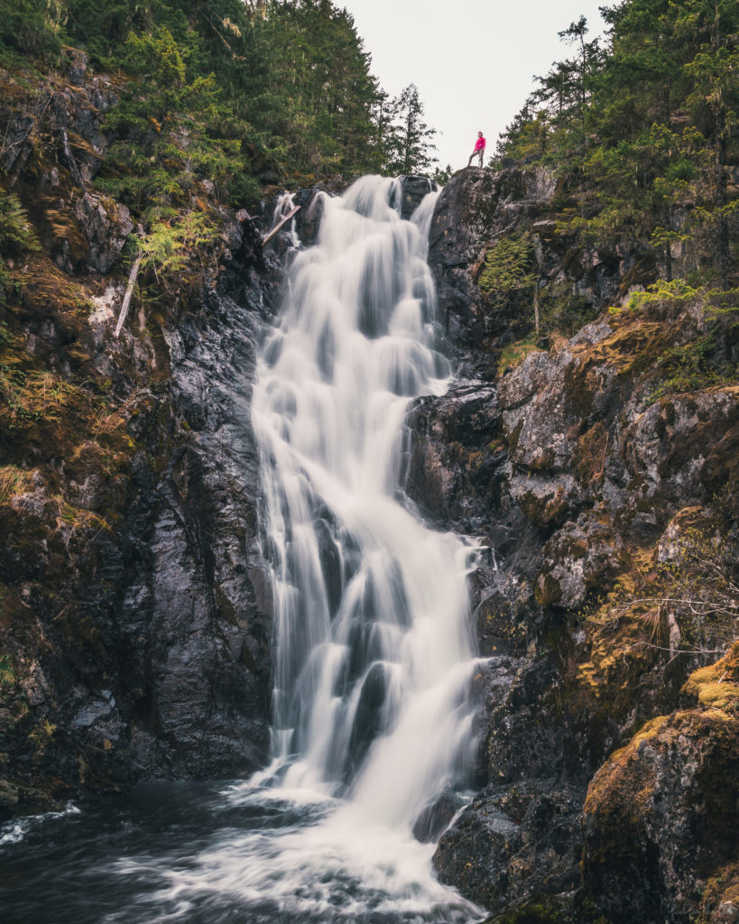
Upper Banon Creek Falls
Stats:
Length 9.8 km, Elevation gain 406 m, Route type Out & back, Difficulty Moderate to hard
AKA. North Banon Creek Falls
This is not a well known hike. You can access it by hiking up Heart/Stocking Lake Trail or you can drive up the Banon Creek Forest Service logging road.
Check AllTrails for exact directions and current trail conditions.
This is a moderately challenging to difficult hike with a technical end section. It leads to a very spectacular waterfall.
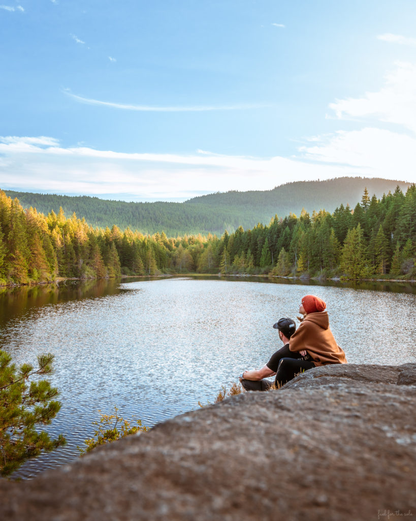
Heart Lake Loop
Stats:
Length 10.1 km, Elevation gain 357 m, Route type, Loop Difficulty Moderate
A moderate 10 km climb up to this peaceful lake. There’s multiple viewpoints and chill spots to spend some time relaxing here.
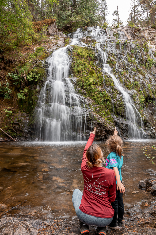
Christie Falls Loop
Stats:
Length 7.1 km, Elevation gain 176 m, Route type Loop, Difficulty Easy
This hike is located near Ladysmith. It is a great family friendly hike and an easy 7 km walk into Christie Falls. This waterfall is truly magical and feels like your own private oasis.
Stocking Creek Park Loop
Stats:
Length 2.4 km, Elevation gain 31 m, Route type Loop, Difficulty Easy
Located in Saltair on Vancouver Island. The park features a loop trail that takes visitors through a variety of natural landscapes, including old-growth forests, creeks, and the Stocking Creek waterfall.
Are you an outdoor enthusiast like us? While you’re here, check out our other outdoor posts:
- ‘Your Day Hiking Essentials Packing List’
- ‘How to Get in Shape for Hiking’
- ‘The Essential Backpacking Packing List’
- ‘Hiking Food Ideas for Healthy Snacks and Meals’
- ‘The Ultimate Camping Packing List – With FREE Printable’
- ‘10 of the BEST Budget Sleeping Bags’
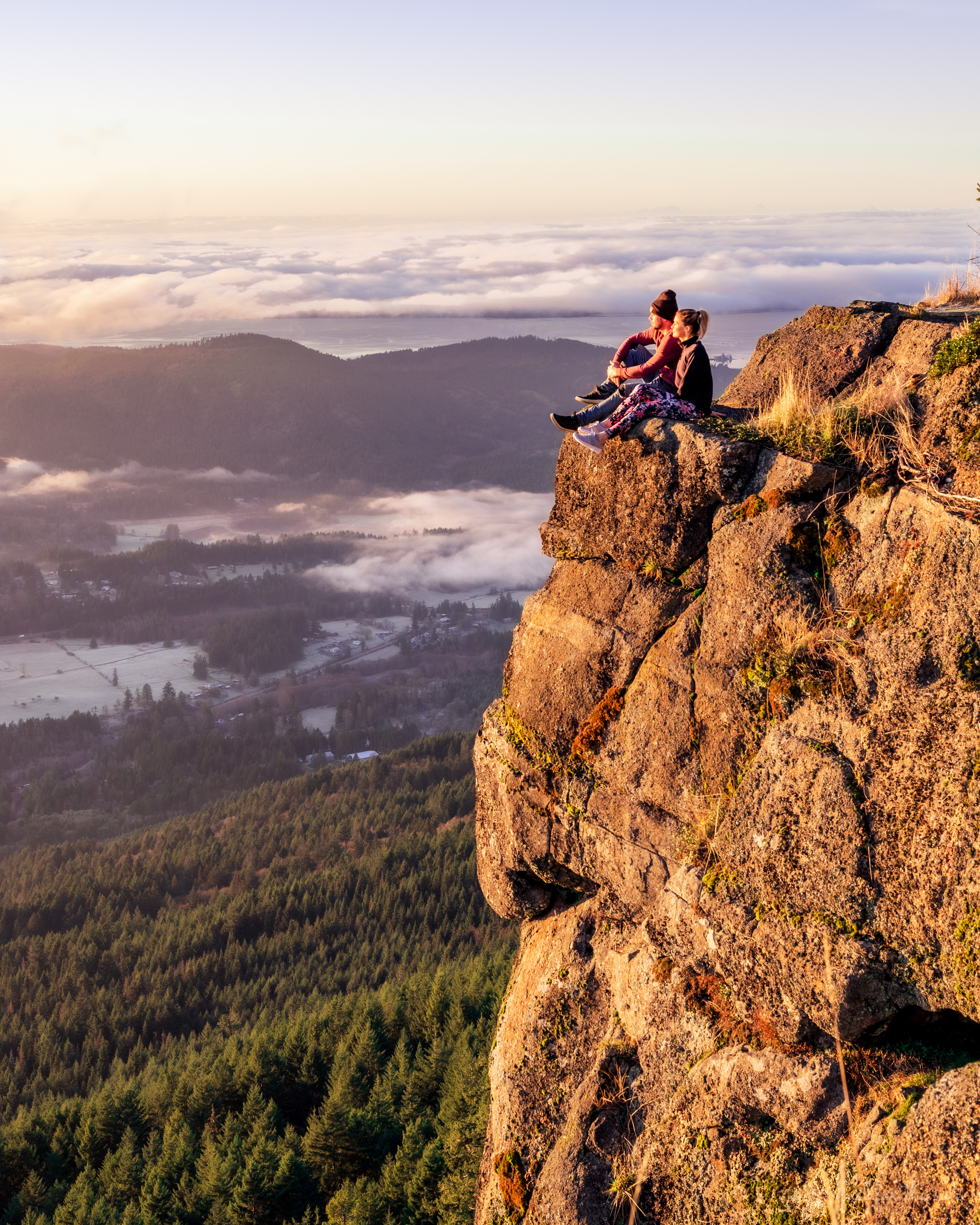
Mount Prevost Trail
Stats:
Length 1.0 km, Elevation gain 77 m, Route type Out & back, Difficulty Hard
Mount Prevost is the highest mountain in Cowichan Valley and it provides one of the best viewpoints on Southern Vancouver Island. You can see the Sea to Sky Mountains and even Mount Baker from the top.
This hike is a difficult 12 km out and back with an elevation gain of 741 m and some rock scrambling as well. The trailhead is accessed off of Drinkwater Rd near Duncan where there is some street parking available.
If you can’t deal with a 12 km hike, you can actually drive up this mountain. The entrance is off of Somenos Rd and a logging road takes you almost all the way to the top. It’s a great way for anyone to take in this fabulous view.
Duncan to Lake Cowichan
Mount Bolduc Ventura Crash Site
Stats:
Length 4.0 km, Elevation gain 223 m, Route type Out & back, Difficulty Moderate
This is a seasonal hike and the trail is covered in snow from October to May. You will need a 4×4 vehicle to get you up to the trailhead.
This trail takes you to a 1944 Ventura plane crash site. It is a war memorial so make sure to respect the area and the remains left behind.
Cowichan Bay, Mill Bay and Shawnigan Lake
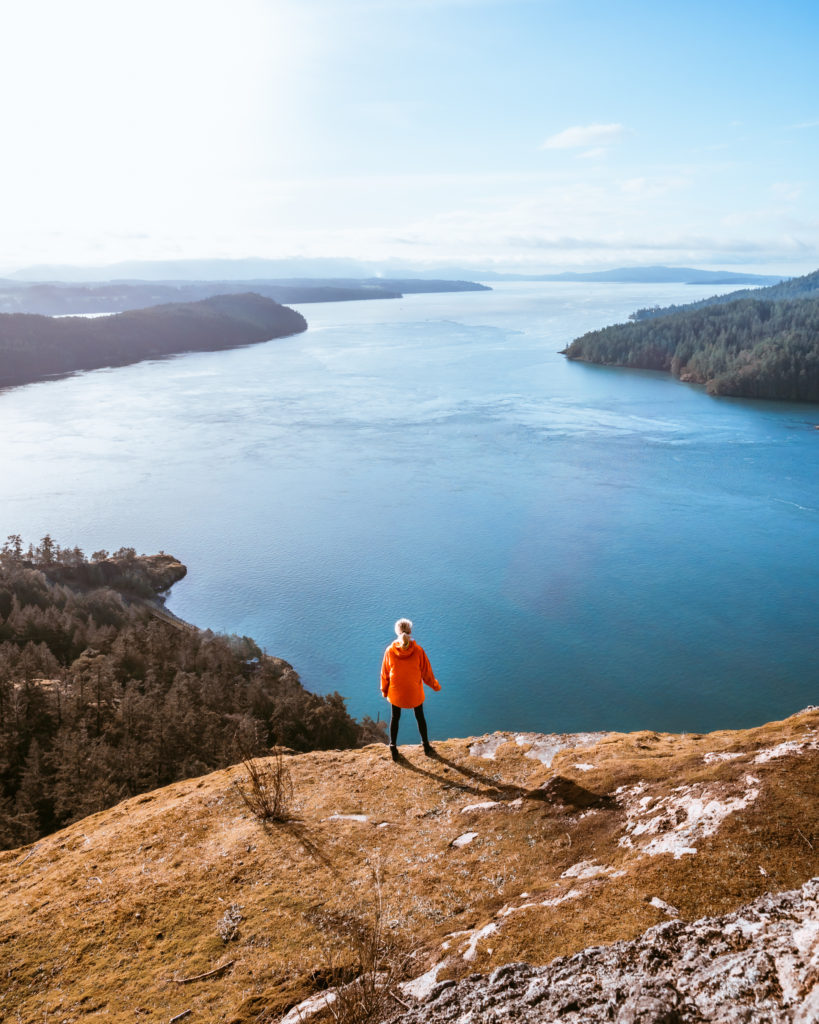
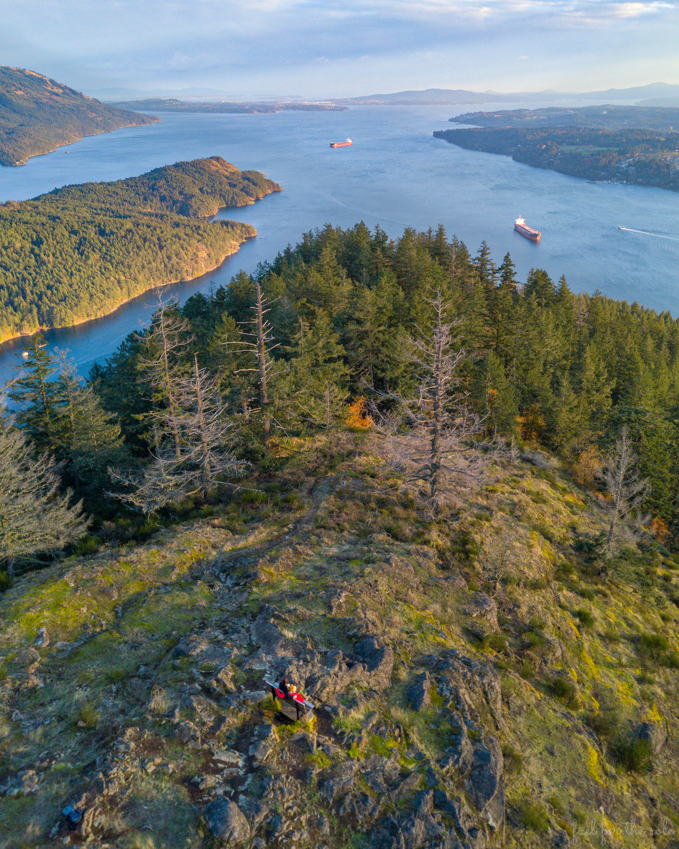
Stoney Hill Trail Loop
Stats:
Length 3.7 km, Elevation gain 115 m, Route type Loop, Difficulty Easy
Huge bang for your buck here as this quick and easy hike takes you to multiple, spectacular viewpoints of Saltspring Island and Sansum Narrows.
This is one of our favourites and is definitely one of the best hikes in Cowichan Valley.
Genoa Bay Mad Dog Trail
Stats:
Length 6.3 km, Elevation gain 459 m, Route Type Out-and-back, Difficulty Moderate to Hard
Short yet strenuous hike up a ridge to the summit for amazing views of Cowichan Bay and beyond.
If you are new to the world of hiking and trekking, there may be some key pieces of gear you need. Remember that safety and comfort are top priorities when you are in backcountry areas. Here are our ‘Top 5 Must-Have Items for Multi-Day Backpacking Trips’:
- BAFX Products Trekking Trail Poles – do not attempt an advanced trail without trekking poles. These things will save your joints from high impact which will keep you hiking longer, safer and happier.
- Cobiz LED Headlamp – Flashlights are so last year.
- Geertop Lightweight Compact Mummy Sleeping Bag – our favourite budget sleeping bag 😊
- Trekology Camping Pillow – At less than 3 oz., this luxury item will significantly improve your rest and recovery.
- Sawyer Products Water Filtration System – lightweight and effective!
Kinsol Trestle Trail
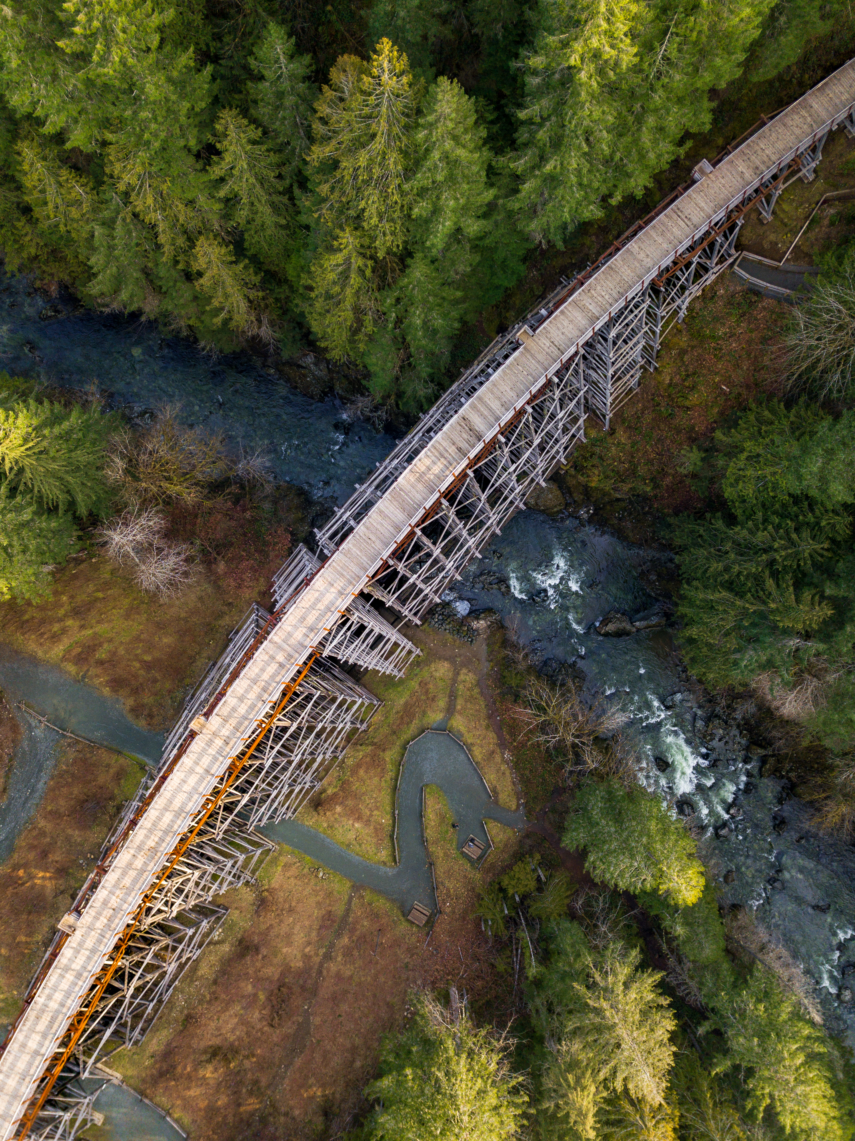
Stats:
Length 3.4 km, Elevation gain 102 m, Route type Out & back, Difficulty Easy
Ths trail is part of the Trans-Canada Trail and runs along the historic Kinsol Trestle, which is one of the tallest and longest wooden trestles in the world.
This hike is located near Shawnigan Lake and is an easy and accessible trail that the whole family can enjoy.
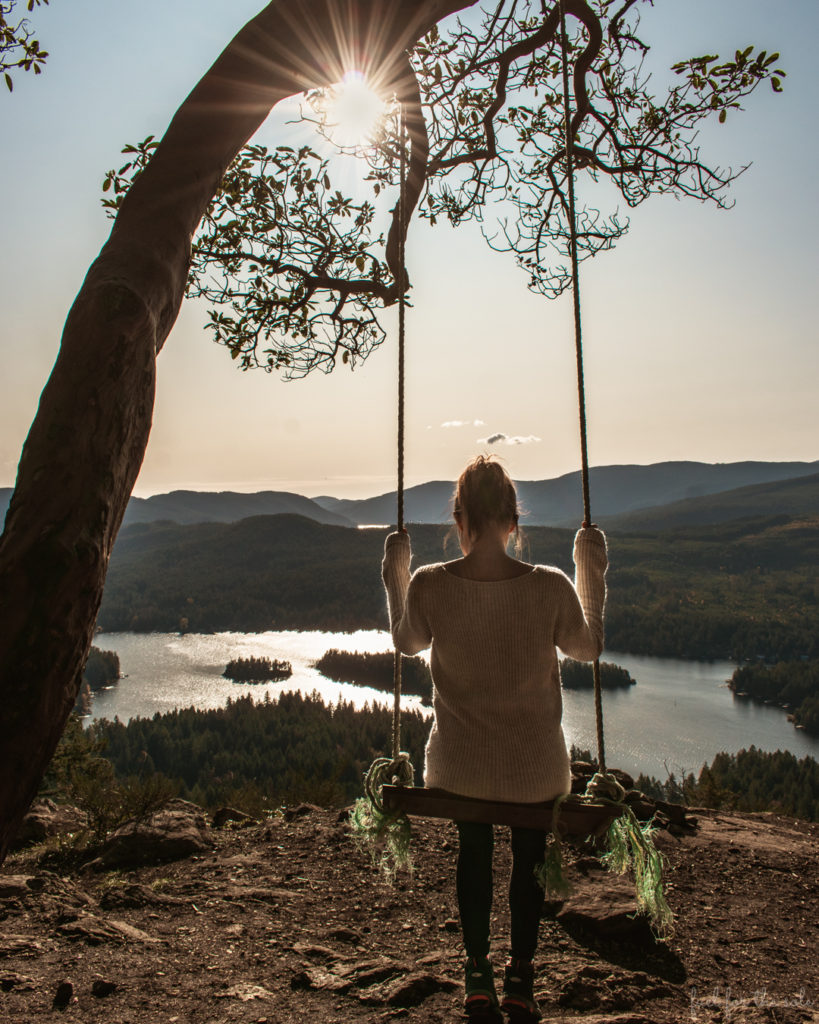
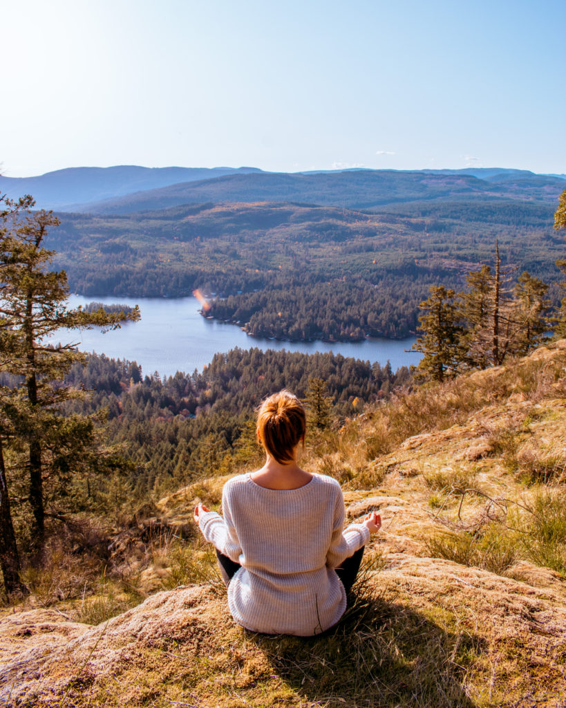
Old Baldy Mountain
Stats:
Length 2.4 km, Elevation gain 208 m, Route type Out & back, Difficulty Moderate
The summit of Old Baldy Mountain offers beautiful views of the surrounding mountains, Cowichan Valley and Shawnigan Lake.
The hike starts with a steep climb through the forest, and then continues along a rocky ridge, which offers some challenging scrambling sections.
Make sure to find the swing!
Vancouver Island offers some of the most beautiful and diverse hiking trails in Canada. From the challenging summit of Mount Prevost to the picturesque Kinsol Trestle Trail, there is something for every level of hiker. We hope this post has inspired you to visit Vancouver Island and explore its natural beauty for yourself.
We would love to hear about your own hiking experiences on the island and your best hikes in Cowichan Valley. Please leave a comment below or share your photos with us! 😊
Love it? Pin it!
*This post may contain affiliate links that help to keep this blog running. Read our disclosure for more information.
2 comments
Fabulous array of outstanding hikes in the Cowichan Valley! The little girl at Christie Falls is adorable.
You gotta love hiking on Vancouver Island!